

Going Green in the Space Age: How Satellite Solutions Improve Environmental Conservation Efforts

How Satellite Solutions Improve Environmental Conservation Efforts
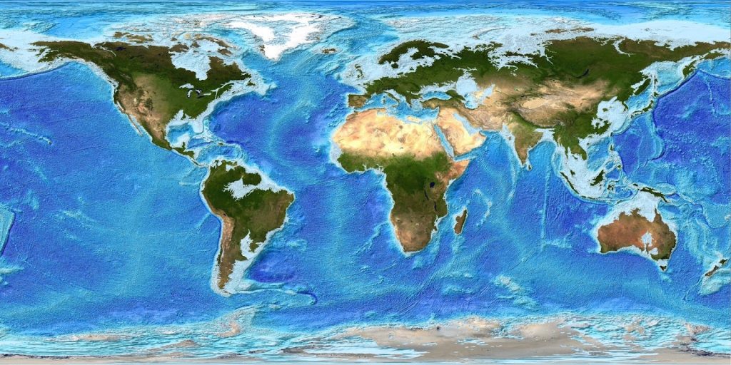
Space technologies have changed the way we protect our planet. These high-tech cameras in space provide us with a complete view of Earth, which was not possible before. They constantly watch our forests, oceans, ice caps, and air with amazing detail. Around-the-clock monitoring with satellite solutions helps scientists spot environmental problems quickly before they become too serious. The ability to see the whole planet at once results in great environmental conservation efforts because such images serve as an important early warning system for threats around the globe.
Satellites Help Us Fight Deforestation
Satellites have become key tools in protecting forests, as conservation groups can spot illegal logging even in hard-to-reach areas thanks to clear pictures from space. These systems can detect tree cutting within 24 hours, which allows quick action. Satellite data also allows to ensure that companies follow rules and make environmental conservation efforts. Forest monitoring from space has already helped us save millions of acres of valuable rainforest that might otherwise have been lost forever.
Satellites Assist in Keeping Seas Healthy
When it comes to environmental conservation efforts, satellites also offer new ways to protect marine life. The thing is that they track sea temperatures to help scientists spot harmful algae growth and coral damage before it is too late. Satellites also monitor illegal fishing by tracking suspicious boat movements in protected waters. These space tools give marine protectors the information they need to create better plans and make environmental conservation efforts. Thanks to regular satellite monitoring, we have more effective marine protected areas where ocean life can thrive without human interference.
Climate Change Chronicles and Environmental Conservation Efforts
What is the main advantage of using satellites to measure climate change? One of the significant benefits of using satellites is their ability to document climate change with clear evidence. They consistently measure rising sea levels, melting ice, carbon in the air, and temperature changes over decades for better environmental conservation efforts. This long-term view provides proof of climate trends, which cannot be captured by ground measurements alone. The ongoing satellite data helps scientists see the difference between natural changes and those caused by humans. This knowledge supports international climate agreements and targeted action plans for environmental conservation efforts.
Satellites Help Us Protect Fresh Water Resources
Freshwater shortages are one of our biggest challenges that require environmental conservation efforts, and satellite solutions are crucial in addressing this issue. The thing is that they successfully monitor underground water levels, track rivers and lakes, and check water quality from space. During droughts or floods, satellite data helps officials distribute resources effectively. These technologies allow communities worldwide to utilise water wisely while protecting important wetland ecosystems. Satellite monitoring can even detect unauthorised water usage, which helps ensure fair distribution of this precious resource in dry regions.
How Does Community Use Satellite Data?
How does satellite imaging help the environment? In fact, it is extremely important because even regular citizens can utilise satellite information to make some environmental conservation efforts. Community science projects use freely available satellite images to monitor nearby forests, track urban development, or document pollution. School classrooms follow satellite data to learn about climate change in real-time. At the same time, conservation volunteers utilise satellite maps to plan habitat restoration projects, while local governments access such information to come up with better decisions about land use and development. This democratisation of space technology means everyone can become an environmental guardian and make environmental conservation efforts.
What About Next-Generation Satellites?
So, how can satellites improve life on Earth? The truth is that our actions are being enhanced with new technologies that offer even better insights for environmental conservation efforts. Recent improvements include:
-
- Special cameras can detect plant health problems before they become visible.
- Advanced radar systems that can see through clouds and even tree tops.
- Small, affordable satellite networks that deliver images more frequently.
- Computer systems that quickly analyse thousands of pictures.
- They track greenhouse gas emissions right at their source.
These technologies are constantly being improved, so we can expect even more powerful tools for successful environmental conservation efforts in the future. These innovations offer our best hope for solving those challenges quickly and effectively.
What Is Your Perspective?
These technologies have already become irreplaceable in environmental conservation. Are satellites useful in understanding long-term changes in climate? The answer is definitely positive. Can they help us come up with the right solutions? Satellites are already providing us with all the crucial data. At the same time, there are many more ways that they are utilised to solve environmental issues. What do you think they are? Share your ideas with us, or tell us what environmental conservation efforts each of us can make.