

Nairobi flood mapping identifies 37 high-risk areas

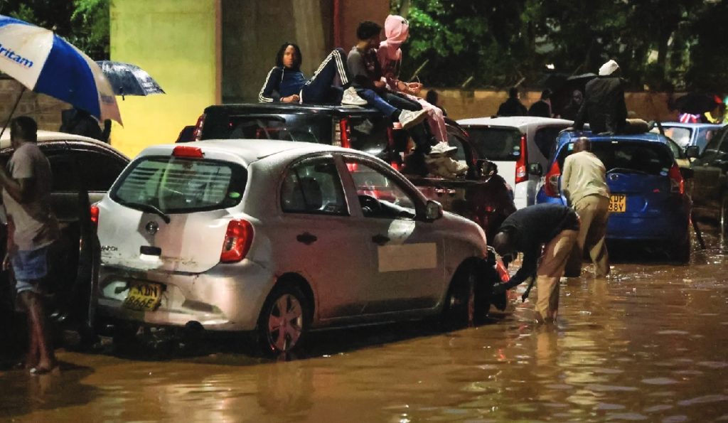
A recent mapping exercise under the Nairobi Rivers Regeneration Programme identified 37 neighbourhoods in Nairobi as highly vulnerable to flooding, highlighting the growing risk posed by the ongoing heavy rains.
The study focused on areas along major river corridors and low-lying sections of the city, pinpointing both upstream and downstream locations prone to water overflow.
• Nairobi East: Kiambiu, Dandora, Kariobangi, Kayole, Komarock, Njiru, Ruai, Mwiki, Donholm, Savannah, Tassia, and Fedha—mostly along sections of the Nairobi River and its tributaries.
• Nairobi West: Madaraka, Nairobi West, Lang’ata, Kawangware, Kangemi, Lavington, Westlands, Parklands, Kitisuru, Spring Valley, Kileleshwa, and Chiromo—situated along upstream and midstream river networks.
• Nairobi North: Mathare, Korogocho, and Lucky Summer—neighbourhoods bordering the Mathare River, with dense settlements close to riverbanks.
• Nairobi Central: Central Business District (CBD), Globe, Gikomba, Eastleigh, and the Industrial Area—sections intersected by the Nairobi River.
• Nairobi South: Kilimani, Kibera, South C, South B, Mukuru Kwa Reuben, and Kwa Njenga—areas along the Ngong River corridor.
Authorities have urged residents living in riparian zones and low-lying areas to exercise extreme caution as multi-agency disaster response teams continue to coordinate relief and rescue operations. Citizens are advised to follow official guidance and prioritize personal safety during heavy rainfall.
This mapping provides critical information for emergency planning and highlights the urgent need for flood mitigation measures in vulnerable parts of the city.
President William Ruto assured Kenyans that the government is fully mobilised to respond to the ongoing heavy rains that have caused flooding in several parts of the country.
In a statement on Sunday, he said the persistent rains continue to pose a threat to lives and livelihoods, expressing sympathy with families and communities already affected by the situation.
“I want to assure all Kenyans that the Government remains fully mobilised to respond,” Ruto said.
He revealed that he had directed the activation of a multi-agency response bringing together emergency services, security agencies, humanitarian teams and technical departments to coordinate relief efforts in Nairobi and other affected regions across the country.
He said government agencies are currently assisting in rescue and evacuation operations, clearing blocked drainage systems and restoring access routes in areas affected by flooding.
Ruto added that the national government is working closely with county governments to ensure the safety of residents, noting that emergency food supplies and medical assistance are already being delivered to affected communities.
He also urged Kenyans to follow safety advisories issued by authorities, including the Kenya Meteorological Department and the police, saying the guidance is intended to help protect lives during the ongoing rains.
“The government will continue to take every necessary step to safeguard lives, support affected communities, and ensure that no Kenyan faces this challenge alone,” he said.